ھۆججەت:Adygea02.png

يۇقىرىراق پەرق ئېتىش نىسبىتى يوق.
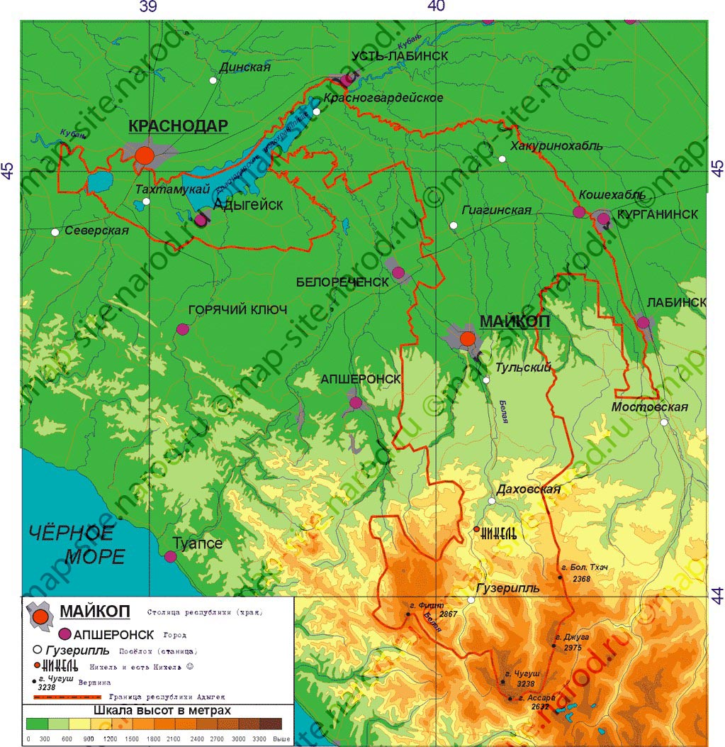
Adygea02.png (699 × 590 پىكسېل، ھۆججەت چوڭلۇقى: 13 KB، MIME تىپى: image/png)
ئۈزۈندە
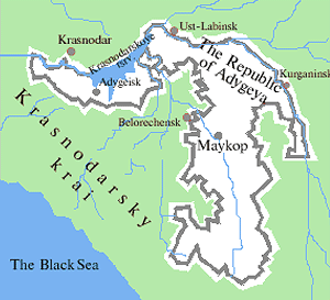
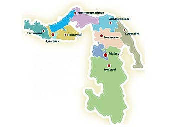
- Map of the Republic of Adygea.
Source and license

|
This map has been uploaded by Electionworld from en.wikipedia.org to enable the |
Map made by PANONIAN
| This work has been released into the public domain by its author, PANONIAN. This applies worldwide. In some countries this may not be legally possible; if so: |
References
- http://map-site.narod.ru/adig-1.jpg
- http://russiatrek.org/images/map/adygeya-republic-map.gif
- http://dic.academic.ru/pictures/wiki/files/65/Adygea_Topography.png
- http://www.rdaward.org/map/6y.jpg
- http://kartoman.ru/wp-content/uploads/2011/04/karta_adigei.jpg
- http://www.msnmappoint.ru/image/Adig_.gif
- http://www.russiamarch.ru/map/karta/Adegea.jpg archive copy at the Wayback Machine
- http://worldgeo.ru/rmaps/reg01m.gif
- http://www.kavkaz.ru/maps/adygy.jpg archive copy at the Wayback Machine
- http://pnr-rodnichok.ru/images/location/Adygeya/Adygeya.jpg[dead link]
- http://img.lenta.ru/news/2009/06/16/adygee/picture.jpg
ھۆججەت تارىخى
چېسلا/ۋاقىت چېكىلسە ئەينى ۋاقىتتا كۆرۈلگەن ھۆججەتنى كۆرسىتىدۇ.
| چېسلا/ۋاقىت | كىچىك سۈرەت | ئۆلچەم | ئىشلەتكۈچى | ئىزاھات | |
|---|---|---|---|---|---|
| نۆۋەتتىكى | 23:16, 31 دېكابىر 2023 | | 699 × 590 (13 KB) | User-duck | Cropped border using CropTool with lossless mode. |
| 14:37, 4 دېكابىر 2011 |  | 731 × 635 (37 KB) | PANONIAN | improved version | |
| 16:10, 29 دېكابىر 2006 |  | 614 × 609 (18 KB) | Electionworld | {{ew|en|PANONIAN}} Map made by PANONIAN {{PD-user|PANONIAN}} Category:Maps of the Russian republics |
ھۆججەت ئىشلىتىلىشى
تۆۋەندىكى بەت بۇ ھۆججەتنى ئىشلىتىدۇ:
ئورتاق ھۆججەت ئىشلىتىلىشى
تۆۋەندىكى باشقا ۋىكىلار بۇ ھۆججەتنى ئىشلىتىدۇ:
- ady.wikipedia.org دىكى ئىشلىتىشى
- bxr.wikipedia.org دىكى ئىشلىتىشى
- ca.wikipedia.org دىكى ئىشلىتىشى
- co.wikipedia.org دىكى ئىشلىتىشى
- el.wikipedia.org دىكى ئىشلىتىشى
- en.wikipedia.org دىكى ئىشلىتىشى
- fa.wikipedia.org دىكى ئىشلىتىشى
- gag.wikipedia.org دىكى ئىشلىتىشى
- ik.wikipedia.org دىكى ئىشلىتىشى
- mk.wikipedia.org دىكى ئىشلىتىشى
- nds.wikipedia.org دىكى ئىشلىتىشى
- pt.wikipedia.org دىكى ئىشلىتىشى
- ro.wikipedia.org دىكى ئىشلىتىشى
- sah.wikipedia.org دىكى ئىشلىتىشى
- sco.wikipedia.org دىكى ئىشلىتىشى
- sh.wikipedia.org دىكى ئىشلىتىشى
- sl.wikipedia.org دىكى ئىشلىتىشى
- sq.wikipedia.org دىكى ئىشلىتىشى
- sv.wikipedia.org دىكى ئىشلىتىشى
- ta.wikipedia.org دىكى ئىشلىتىشى
- tl.wikipedia.org دىكى ئىشلىتىشى
- tr.wikipedia.org دىكى ئىشلىتىشى
- udm.wikipedia.org دىكى ئىشلىتىشى
- uk.wikipedia.org دىكى ئىشلىتىشى
- war.wikipedia.org دىكى ئىشلىتىشى
- zh.wikipedia.org دىكى ئىشلىتىشى