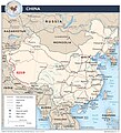
ئەسلى ھۆججەت(2,008 × 2,212 پىكسېل، ھۆججەت چوڭلۇقى: 1.09 MB، MIME تىپى: image/jpeg)

بۇ ھۆججەت ۋىكى ۋاستە ھەمبەھىر دىن كەلگەن، ئۇ باشقا قۇرۇلۇشتا ئىشلىتىلىشى مۇمكىن. ھۆججەت چۈشەندۈرۈش بېتى نىڭ چۈشەندۈرۈشى تۆۋەندە كۆرسىتىلىدۇ.

ئۈزۈندە

چۈشەندۈرۈش
English: map of the G219 road in PRC
چېسلا
مەنبە https://www.cia.gov/library/publications/cia-maps-publications/map-downloads/china_transportation.jpg
يازغۇچى CIA (edited by SyntaxTerror)

ئىجازەت

Public domain
This work is in the public domain in the United States because it is a work prepared by an officer or employee of the United States Government as part of that person’s official duties under the terms of Title 17, Chapter 1, Section 105 of the US Code. Note: This only applies to original works of the Federal Government and not to the work of any individual U.S. state, territory, commonwealth, county, municipality, or any other subdivision. This template also does not apply to postage stamp designs published by the United States Postal Service since 1978. (See § 313.6(C)(1) of Compendium of U.S. Copyright Office Practices). It also does not apply to certain US coins; see The US Mint Terms of Use.

Captions

Add a one-line explanation of what this file represents

Items portrayed in this file

depicts ئىنگلىزچە

inception ئىنگلىزچە

20 ئىيۇل 2011

ھۆججەت تارىخى

چېسلا/ۋاقىت چېكىلسە ئەينى ۋاقىتتا كۆرۈلگەن ھۆججەتنى كۆرسىتىدۇ.

چېسلا/ۋاقىتكىچىك سۈرەتئۆلچەمئىشلەتكۈچىئىزاھات
نۆۋەتتىكى14:36, 17 ئىيۇل 201214:36, 17 ئىيۇل 2012 نىڭ كىچىك سۈرەت نەشرى2,008 × 2,212 (1.09 MB)SyntaxTerror

تۆۋەندىكى بەت بۇ ھۆججەتنى ئىشلىتىدۇ:

ئورتاق ھۆججەت ئىشلىتىلىشى

تۆۋەندىكى باشقا ۋىكىلار بۇ ھۆججەتنى ئىشلىتىدۇ:

مېتامەلۇمات