ھۆججەت:Kunlun IMG 0541.jpg
بۇ ئالدىن كۆزىتىشنىڭ چوڭلۇقى: 800 × 600 پىكسېل. باشقا چوڭلۇقى: 320 × 240 پىكسېل | 640 × 480 پىكسېل | 1,024 × 768 پىكسېل | 1,280 × 960 پىكسېل | 2,272 × 1,704 پىكسېل.
ئەسلى ھۆججەت (2,272 × 1,704 پىكسېل، ھۆججەت چوڭلۇقى: 1.56 MB، MIME تىپى: image/jpeg)
| چۈشەندۈرۈش |
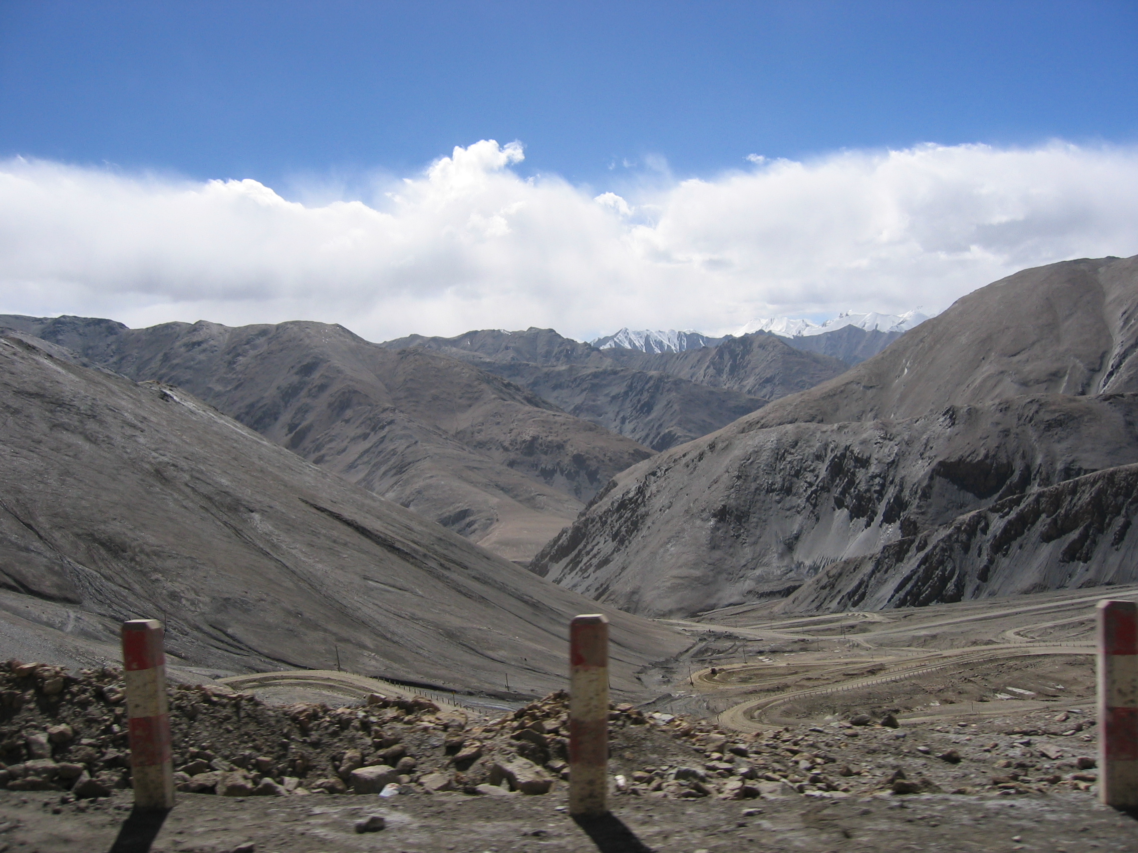
English: View of Western Kunlun Shan from the Tibet-Xinjiang highway |
||
| چېسلا | July of 2004 while on a geological expedition from UC Davis | ||
| مەنبە | en | ||
| يازغۇچى | Photo taken by Nick Kent-Basham | ||
| ھوقۇق (بۇ ھۆججەتنى قايتىلاپ ئىشلىتىش) |
|
| Camera location | | View this and other nearby images on: OpenStreetMap |
|---|
The geographical information in this file was retrospectively estimated.
The location may therefore be somewhat imprecise. Verifying and refining these coordinates is strongly encouraged. |
ھۆججەت تارىخى
چېسلا/ۋاقىت چېكىلسە ئەينى ۋاقىتتا كۆرۈلگەن ھۆججەتنى كۆرسىتىدۇ.
| چېسلا/ۋاقىت | كىچىك سۈرەت | ئۆلچەم | ئىشلەتكۈچى | ئىزاھات | |
|---|---|---|---|---|---|
| نۆۋەتتىكى | 19:48, 11 مارت 2007 | | 2,272 × 1,704 (1.56 MB) | Hugo.arg | {{Information |Description=View of Western Kunlun Shan from the Tibet-Xinjiang highway |Source=[http://en.wikipedia.org/wiki/Image:IMG_0541.jpg en] |Date= July of 2004 while on a geological expedition from UC Davis |Author=Photo taken by Nick Kent-Basham |
ھۆججەت ئىشلىتىلىشى
تۆۋەندىكى بەت بۇ ھۆججەتنى ئىشلىتىدۇ:
ئورتاق ھۆججەت ئىشلىتىلىشى
تۆۋەندىكى باشقا ۋىكىلار بۇ ھۆججەتنى ئىشلىتىدۇ:
- af.wikipedia.org دىكى ئىشلىتىشى
- ast.wikipedia.org دىكى ئىشلىتىشى
- ba.wikipedia.org دىكى ئىشلىتىشى
- be.wikipedia.org دىكى ئىشلىتىشى
- bg.wikipedia.org دىكى ئىشلىتىشى
- bn.wikipedia.org دىكى ئىشلىتىشى
- ca.wikipedia.org دىكى ئىشلىتىشى
- cs.wikipedia.org دىكى ئىشلىتىشى
- de.wikipedia.org دىكى ئىشلىتىشى
- en.wikipedia.org دىكى ئىشلىتىشى
- es.wikipedia.org دىكى ئىشلىتىشى
- he.wikipedia.org دىكى ئىشلىتىشى
- hr.wikipedia.org دىكى ئىشلىتىشى
- hu.wikipedia.org دىكى ئىشلىتىشى
- it.wikipedia.org دىكى ئىشلىتىشى
- ka.wikipedia.org دىكى ئىشلىتىشى
- ko.wikipedia.org دىكى ئىشلىتىشى
- lt.wikipedia.org دىكى ئىشلىتىشى
- nl.wikipedia.org دىكى ئىشلىتىشى
- no.wikipedia.org دىكى ئىشلىتىشى
- ro.wikipedia.org دىكى ئىشلىتىشى
- ru.wikipedia.org دىكى ئىشلىتىشى
- sh.wikipedia.org دىكى ئىشلىتىشى
- sk.wikipedia.org دىكى ئىشلىتىشى
- sr.wikipedia.org دىكى ئىشلىتىشى
- sv.wikipedia.org دىكى ئىشلىتىشى
- sw.wikipedia.org دىكى ئىشلىتىشى
- th.wikipedia.org دىكى ئىشلىتىشى
- tt.wikipedia.org دىكى ئىشلىتىشى
- uk.wikipedia.org دىكى ئىشلىتىشى
- vi.wikipedia.org دىكى ئىشلىتىشى
- www.wikidata.org دىكى ئىشلىتىشى
- zh.wikipedia.org دىكى ئىشلىتىشى