ھۆججەت:Localización de Andalucía.svg

Size of this PNG preview of this SVG file: 686 × 518 پىكسېل. باشقا چوڭلۇقى: 318 × 240 پىكسېل | 636 × 480 پىكسېل | 1,017 × 768 پىكسېل | 1,280 × 967 پىكسېل | 2,560 × 1,933 پىكسېل.
ئەسلى ھۆججەت (SVG ھۆججىتى، ئاتاقتىكى چوڭلۇقى 686 × 518 نۇقتا، ھۆججەت چوڭلۇقى: 502 KB)
ئۈزۈندە
| چۈشەندۈرۈش |
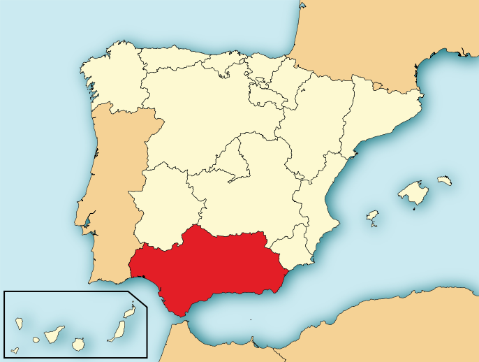
English: Map of Spain with Andalusia highlighted. Español: Localización de Andalucía respecto a España. |
| چېسلا | |
| مەنبە | File:EspañaLoc.svg, de HansenBCN. Modificada por User:Mutxamel. |
| يازغۇچى | Mutxamel, subido por Rastrojo •ES) |
| Other versions |
Derivative works of this file: |
| SVG genesis | This locator map was created with Adobe Illustrator. |

ئىجازەت
I, the copyright holder of this work, hereby publish it under the following licenses:

|
Permission is granted to copy, distribute and/or modify this document under the terms of the GNU Free Documentation License, Version 1.2 or any later version published by the Free Software Foundation; with no Invariant Sections, no Front-Cover Texts, and no Back-Cover Texts. A copy of the license is included in the section entitled GNU Free Documentation License. |
This file is licensed under the Creative Commons Attribution-Share Alike 4.0 International, 3.0 Unported, 2.5 Generic, 2.0 Generic and 1.0 Generic license.
- سىز ئەركىن:
- بەھىرلەش – to copy, distribute and transmit the work
- ئۆزگەرتىش – ئىجادىي ئەسەر
- تۆۋەندىكى شەرتلەرگە چوقۇم ئەمەل قىلىڭ:
- ئىمزا – You must give appropriate credit, provide a link to the license, and indicate if changes were made. You may do so in any reasonable manner, but not in any way that suggests the licensor endorses you or your use.
- ئوخشاش ئۇسۇلدا بەھىرلەش – If you remix, transform, or build upon the material, you must distribute your contributions under the same or compatible license as the original.
You may select the license of your choice.
ھۆججەت تارىخى
چېسلا/ۋاقىت چېكىلسە ئەينى ۋاقىتتا كۆرۈلگەن ھۆججەتنى كۆرسىتىدۇ.
| چېسلا/ۋاقىت | كىچىك سۈرەت | ئۆلچەم | ئىشلەتكۈچى | ئىزاھات | |
|---|---|---|---|---|---|
| نۆۋەتتىكى | 19:21, 4 ئاۋغۇست 2010 | | 686 × 518 (502 KB) | Orionist | removed border and artifacts, various other fixes |
| 11:00, 6 ئىيۇل 2009 |  | 690 × 522 (562 KB) | Rastrojo | nueva versión | |
| 18:31, 2 ئاپرېل 2008 |  | 578 × 374 (407 KB) | Paintman | Color verde y por comunidades autónomas. | |
| 19:52, 7 يانۋار 2008 |  | 578 × 374 (608 KB) | Rastrojo | {{Information |Description= Localización de Andalucía respecto a España |Source= Image:Provincias de España centrado.svg |Date= |Author= Rastrojo |Permission= |other_versions= }} [[Category:Maps of Spai |
ھۆججەت ئىشلىتىلىشى
تۆۋەندىكى بەت بۇ ھۆججەتنى ئىشلىتىدۇ:
ئورتاق ھۆججەت ئىشلىتىلىشى
تۆۋەندىكى باشقا ۋىكىلار بۇ ھۆججەتنى ئىشلىتىدۇ:
- ace.wikipedia.org دىكى ئىشلىتىشى
- af.wikipedia.org دىكى ئىشلىتىشى
- als.wikipedia.org دىكى ئىشلىتىشى
- an.wikipedia.org دىكى ئىشلىتىشى
- ar.wikipedia.org دىكى ئىشلىتىشى
- arz.wikipedia.org دىكى ئىشلىتىشى
- ast.wikipedia.org دىكى ئىشلىتىشى
- ast.wiktionary.org دىكى ئىشلىتىشى
- ay.wikipedia.org دىكى ئىشلىتىشى
- az.wikipedia.org دىكى ئىشلىتىشى
- be-tarask.wikipedia.org دىكى ئىشلىتىشى
- be.wikipedia.org دىكى ئىشلىتىشى
- bg.wikipedia.org دىكى ئىشلىتىشى
- br.wikipedia.org دىكى ئىشلىتىشى
- br.wiktionary.org دىكى ئىشلىتىشى
- ca.wikipedia.org دىكى ئىشلىتىشى
- ceb.wikipedia.org دىكى ئىشلىتىشى
- crh.wikipedia.org دىكى ئىشلىتىشى
- cs.wikipedia.org دىكى ئىشلىتىشى
- da.wikipedia.org دىكى ئىشلىتىشى
- de.wikipedia.org دىكى ئىشلىتىشى
- de.wikivoyage.org دىكى ئىشلىتىشى
- diq.wikipedia.org دىكى ئىشلىتىشى
- el.wikipedia.org دىكى ئىشلىتىشى
- el.wiktionary.org دىكى ئىشلىتىشى
- en.wikipedia.org دىكى ئىشلىتىشى
- en.wiktionary.org دىكى ئىشلىتىشى
- eo.wikipedia.org دىكى ئىشلىتىشى
- eo.wiktionary.org دىكى ئىشلىتىشى
- es.wikipedia.org دىكى ئىشلىتىشى
View more global usage of this file.