ھۆججەت:Mongols-map.png
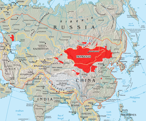
بۇ ئالدىن كۆزىتىشنىڭ چوڭلۇقى: 722 × 599 پىكسېل. باشقا چوڭلۇقى: 289 × 240 پىكسېل | 578 × 480 پىكسېل | 925 × 768 پىكسېل | 1,234 × 1,024 پىكسېل | 1,801 × 1,495 پىكسېل.
ئەسلى ھۆججەت (1,801 × 1,495 پىكسېل، ھۆججەت چوڭلۇقى: 2.79 MB، MIME تىپى: image/png)
ئۈزۈندە
| چۈشەندۈرۈش |
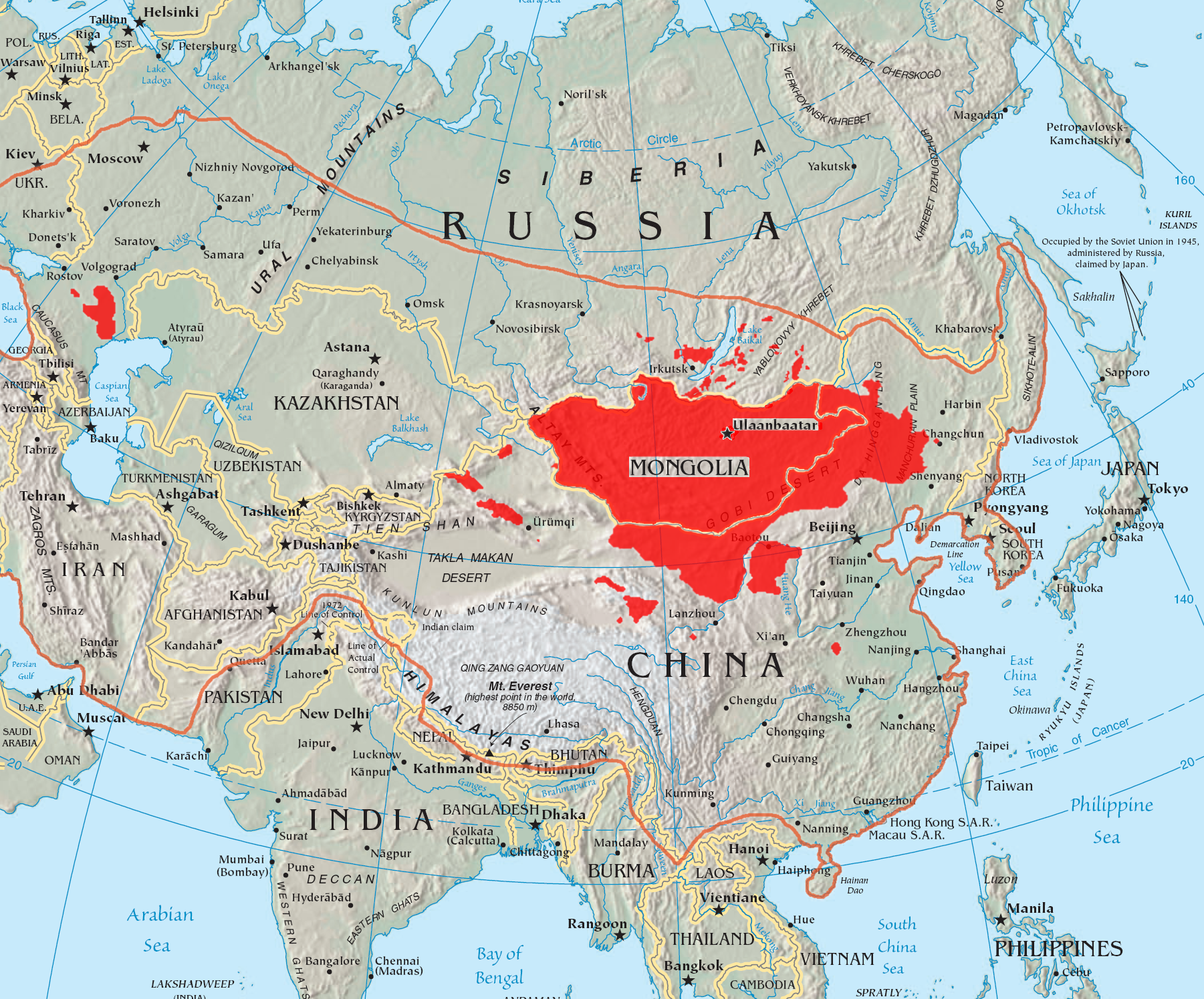
English: A map of the places that Mongol peoples live.
The orange line shows the extent of the Mongol Empire in the late 13th century. The red areas are the places dominated by ethnic Mongols. |
| چېسلا | |
| مەنبە |
|
| يازغۇچى | Quadell |

|
This linguistic map image could be re-created using vector graphics as an SVG file. This has several advantages; see Commons:Media for cleanup for more information. If an SVG form of this image is available, please upload it and afterwards replace this template with
{{vector version available|new image name}}.
It is recommended to name the SVG file “Mongols-map.svg”—then the template Vector version available (or Vva) does not need the new image name parameter. |
ئىجازەت
I, the copyright holder of this work, hereby publish it under the following licenses:

|
Permission is granted to copy, distribute and/or modify this document under the terms of the GNU Free Documentation License, Version 1.2 or any later version published by the Free Software Foundation; with no Invariant Sections, no Front-Cover Texts, and no Back-Cover Texts. A copy of the license is included in the section entitled GNU Free Documentation License. |
| This file is licensed under the Creative Commons Attribution-Share Alike 3.0 Unported license. | ||
| ||
| This licensing tag was added to this file as part of the GFDL licensing update. |
This file is licensed under the Creative Commons Attribution-Share Alike 2.0 Generic license.
- سىز ئەركىن:
- بەھىرلەش – to copy, distribute and transmit the work
- ئۆزگەرتىش – ئىجادىي ئەسەر
- تۆۋەندىكى شەرتلەرگە چوقۇم ئەمەل قىلىڭ:
- ئىمزا – You must give appropriate credit, provide a link to the license, and indicate if changes were made. You may do so in any reasonable manner, but not in any way that suggests the licensor endorses you or your use.
- ئوخشاش ئۇسۇلدا بەھىرلەش – If you remix, transform, or build upon the material, you must distribute your contributions under the same or compatible license as the original.
You may select the license of your choice.
ھۆججەت تارىخى
چېسلا/ۋاقىت چېكىلسە ئەينى ۋاقىتتا كۆرۈلگەن ھۆججەتنى كۆرسىتىدۇ.
| چېسلا/ۋاقىت | كىچىك سۈرەت | ئۆلچەم | ئىشلەتكۈچى | ئىزاھات | |
|---|---|---|---|---|---|
| نۆۋەتتىكى | 14:37, 29 ماي 2023 | | 1,801 × 1,495 (2.79 MB) | Artanisen | High resolution map with the same borders and areas as version 17:34, 16 July 2005 (UTC) |
| 20:13, 10 ئاپرېل 2021 |  | 728 × 525 (279 KB) | Fæ | Reverted to version as of 17:34, 16 July 2005 (UTC) Untrusted work of sockpuppets | |
| 03:35, 17 يانۋار 2019 |  | 728 × 525 (295 KB) | Anchuhu | mongol | |
| 10:56, 22 ئىيۇن 2017 |  | 728 × 525 (630 KB) | 일성강 | Reverted to version as of 12:47, 1 June 2017 (UTC) | |
| 08:54, 17 ئىيۇن 2017 |  | 728 × 525 (279 KB) | Calthinus | Reverted to version as of 17:34, 16 July 2005 (UTC) | |
| 12:47, 1 ئىيۇن 2017 |  | 728 × 525 (630 KB) | 일성강 | fixed | |
| 17:34, 16 ئىيۇل 2005 |  | 728 × 525 (279 KB) | Hottentot~commonswiki | This is a map of the places that Mongol peoples live. The information is based off of w:en:Image:Mongolsethnic.jpg, and the map I started with is w:en:Image:Asia-map.png. The orange line shows the extent of the Mongol Empire in the late 13th c | |
| 13:14, 16 ئىيۇل 2005 |  | 728 × 525 (297 KB) | Quadell | This is a map of the places that Mongol peoples live. The information is based off of [:w:en:Image:Mongolsethnic.jpg]], and the map I started with is w:en:Image:Asia-map.png. The orange line shows the extent of the Mongol Empire in the late 13th ce |
ھۆججەت ئىشلىتىلىشى
تۆۋەندىكى بەت بۇ ھۆججەتنى ئىشلىتىدۇ:
ئورتاق ھۆججەت ئىشلىتىلىشى
تۆۋەندىكى باشقا ۋىكىلار بۇ ھۆججەتنى ئىشلىتىدۇ:
- af.wikipedia.org دىكى ئىشلىتىشى
- an.wikipedia.org دىكى ئىشلىتىشى
- ar.wikipedia.org دىكى ئىشلىتىشى
- arz.wikipedia.org دىكى ئىشلىتىشى
- ast.wikipedia.org دىكى ئىشلىتىشى
- azb.wikipedia.org دىكى ئىشلىتىشى
- ba.wikipedia.org دىكى ئىشلىتىشى
- be-tarask.wikipedia.org دىكى ئىشلىتىشى
- be.wikipedia.org دىكى ئىشلىتىشى
- bg.wiktionary.org دىكى ئىشلىتىشى
- bh.wikipedia.org دىكى ئىشلىتىشى
- br.wikipedia.org دىكى ئىشلىتىشى
- bs.wikipedia.org دىكى ئىشلىتىشى
- ca.wikipedia.org دىكى ئىشلىتىشى
- ckb.wikipedia.org دىكى ئىشلىتىشى
- cs.wikipedia.org دىكى ئىشلىتىشى
- cv.wikipedia.org دىكى ئىشلىتىشى
- da.wikipedia.org دىكى ئىشلىتىشى
- diq.wikipedia.org دىكى ئىشلىتىشى
- dsb.wikipedia.org دىكى ئىشلىتىشى
- el.wikipedia.org دىكى ئىشلىتىشى
- en.wikipedia.org دىكى ئىشلىتىشى
View more global usage of this file.