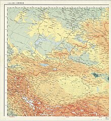
ھۆججەت:Republic of China edcp location map (disputed territories).svg

Size of this PNG preview of this SVG file: 512 × 399 پىكسېل. باشقا چوڭلۇقى: 308 × 240 پىكسېل | 616 × 480 پىكسېل | 986 × 768 پىكسېل | 1,280 × 998 پىكسېل | 2,560 × 1,995 پىكسېل.
ئەسلى ھۆججەت (SVG ھۆججىتى، ئاتاقتىكى چوڭلۇقى 512 × 399 نۇقتا، ھۆججەت چوڭلۇقى: 7.89 MB)
ھۆججەت تارىخى
چېسلا/ۋاقىت چېكىلسە ئەينى ۋاقىتتا كۆرۈلگەن ھۆججەتنى كۆرسىتىدۇ.
| چېسلا/ۋاقىت | كىچىك سۈرەت | ئۆلچەم | ئىشلەتكۈچى | ئىزاھات | |
|---|---|---|---|---|---|
| نۆۋەتتىكى | 13:19, 8 ئۆكتەبىر 2024 |  | 512 × 399 (7.89 MB) | Lilauid | 依照各省分縣、郵政區地圖更新邊界 |
| 02:58, 31 ئىيۇل 2024 |  | 512 × 399 (7.25 MB) | Lilauid | 圖層整理,邊界小修正 | |
| 07:31, 30 ئىيۇل 2024 |  | 512 × 399 (7.26 MB) | Lilauid | 更新地圖,根據中華民國五十五年十月聯合勤務總司令部印之第二版二百五十萬分之一中華民國全圖更新邊界 | |
| 08:03, 25 ئىيۇل 2024 |  | 512 × 399 (6.22 MB) | Lilauid | 根據兩百五十萬比一中華民國地圖修正邊界 | |
| 13:12, 9 ئىيۇل 2024 |  | 512 × 399 (6.12 MB) | Lilauid | 修正邊界 | |
| 08:27, 15 ئىيۇن 2024 |  | 512 × 399 (6.24 MB) | Lilauid | 修訂和添加多處邊界 | |
| 22:46, 29 ماي 2024 |  | 512 × 399 (6.44 MB) | Lilauid | 根據內政部1987年出版的中華民國全圖(兩百五十萬分之一)修改、細化邊界 | |
| 10:20, 29 ماي 2024 |  | 512 × 399 (6.4 MB) | Lilauid | 修正邊界 | |
| 06:26, 28 ماي 2024 |  | 512 × 399 (6.39 MB) | Lilauid | {{Information |Description=包含爭議領土的中華民國行政區劃地圖(公告行政區劃) |Source=File:Republic_of_China_edcp_location_map.svg |Date=2024-05-28 |Author=Lilauid |Permission= |other_versions={{Template:中華民國行政區劃地圖}}}} |
ھۆججەت ئىشلىتىلىشى
بۇ ھۆججەتنى ئىشلەتكەن بەت يوق.
ئورتاق ھۆججەت ئىشلىتىلىشى
تۆۋەندىكى باشقا ۋىكىلار بۇ ھۆججەتنى ئىشلىتىدۇ:
- ca.wikipedia.org دىكى ئىشلىتىشى
- en.wikipedia.org دىكى ئىشلىتىشى
- pt.wikipedia.org دىكى ئىشلىتىشى
- www.wikidata.org دىكى ئىشلىتىشى
- zh.wikipedia.org دىكى ئىشلىتىشى
View more global usage of this file.


